


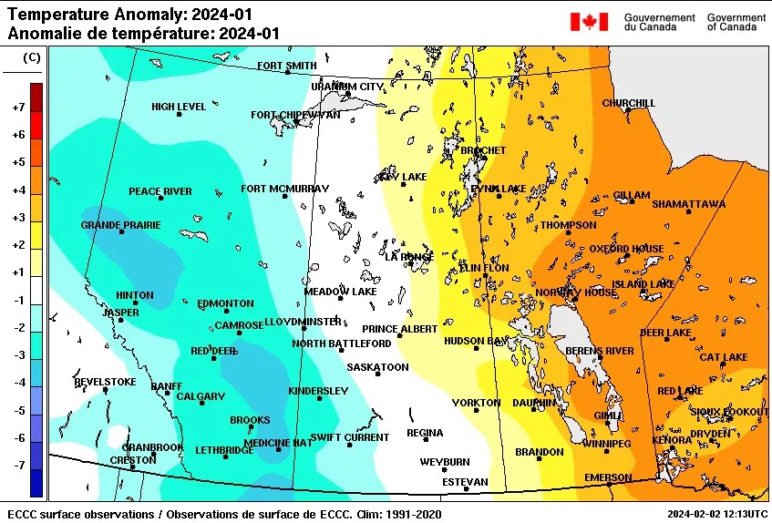
January was a roller-coaster of a month – from warm & dry to very cold, then warm again.
Environment Canada Meteorologist Terri Lang says the beginning of the month was like December, warm and dry, then during the second week some arctic air landed on the province, resulting in a cold snap for several days. There were 27 new cold temperatures records made, with the coldest community being Leader at -46.4 degrees.
In contrast, the warming period of January 27th to 31st resulted in 69 new temperature records made around the province with Maple Creek topping out at 21.1 degrees. Sixteen days earlier, Maple Creek’s coldest temperature was -42.5 — a 63.6 degree temperature swing in that timeframe.
“It’s a huge swing,” Lang stated.
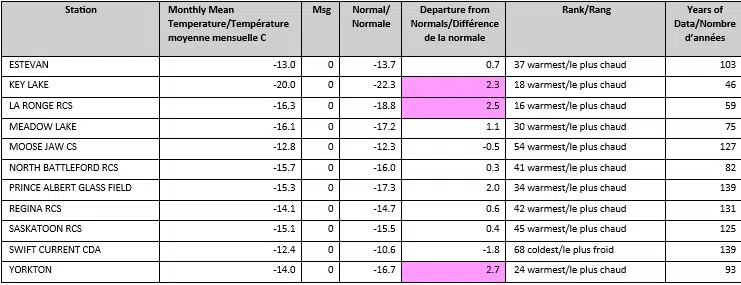
While a chart of monthly mean temperatures at each weather station in Saskatchewan showed mild temperatures around the mid-teens, Lang says it doesn’t tell the whole story because of the two extremes we had.
Precipitation was minimal for most of the province during the first half of the month, with the exception of the far north where it was close to average to above average.
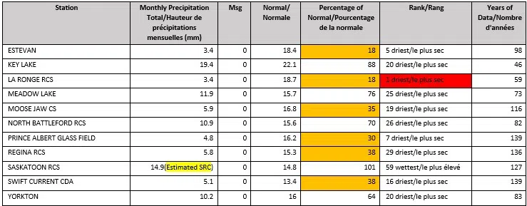
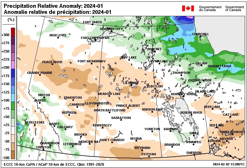
The northern grain belt and Parkland Region got some snow, but Lang knows more is needed for farmers.
“Snowfall is kind of like putting moisture in the bank for the spring and hope that it makes it into the soil because it’s been running pretty dry for a pretty long time, and because we’re at such a precipitation deficit…it’s not going to take one or two rainfalls in the spring to make up for it all,” Lang said. “It’ll help with the near surface moisture but overall it’s been so dry for so long that a lot more moisture is needed.”
Lang noted the El Nino caused the warmer than normal weather in the province and its forecast to start weakening in the spring with a La Nina in the fall. She also said February is forecast to be above average for temperatures and drier than average.
However, Lang says there is hope for more moisture between now and when producers start seeding in the spring. She noted a recent Colorado Low in the southern part of the province, near the U.S. border, brought a lot of snow and is hopeful for additional snowfall between March and April.
“March and April are Colorado Low type of months, and that’s when we can often see our heaviest snowfalls so there’s still some hope left.”


