


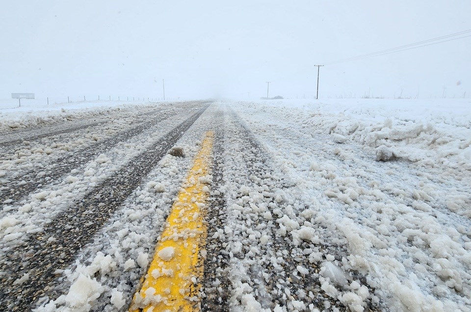
SASKATCHEWAN — Saskatchewan residents continue to take the brunt of a powerful winter storm that descended on the province on Feb. 17.
Danielle Desjardins, a meteorologist with Environment and Climate Change Canada, told SaskToday that snow is ongoing from an area west of Moose Jaw to the Manitoba border, and from the Canada-U.S. border to beyond Prince Albert.
“The heaviest band looks to be just east of Saskatoon, almost north-south, and extending down through Regina,” she said.
The snow is going to continue throughout the day on Feb. 18, she said, and should taper off this afternoon and overnight into Feb. 19.
Winds have calmed down a bit, she said, but reduced visibility continues due to falling and blowing snow. Desjardins noted travel is not recommended in many areas, according to the Highway Hotline.
A few snowfall measurements have been reported already, she said. Holbein, in the north-central area, received 27.9 centimetres, while Emma Lake, also in the north-central area, had 25.4 centimetres. Prince Albert had 25 centimetres. A large area of Meadow Lake received heavier snow, she said. Amounts have been “more or less” what was expected, she said, but Environment Canada is waiting to see if more observers come through with their reports.
“We do rely a lot on volunteer observers for our snowfall data,” she said.
More heavy snow is on its way for Regina, she said, with accumulations of five to 10 centimetres on Feb. 18, to go with reduced visibility and blowing snow at times.
“In behind this system, we’re going to see temperatures falling to below normal as a ridge of high pressure brings in some colder Arctic air to the province,” said Desjardins.
Daytime highs are expected to be colder than -13 C, while overnight lows are to be well into the –20s C, she said.
As for Saskatoon, accumulating snow is expected, she said, with at least 10 centimetres. Snow is expected to be light this evening. Winds are not expected to be as strong as elsewhere. Cold temperatures are also expected to follow.
Desjardins predicted the advisories would start to end as the system tracks to the east. She expects improvement from west to east.
“I would expect Saskatoon will be ending sooner than Regina, but once the heavy snow has ceased, that’s when we’ll start seeing the advisories ending.”
She doubts further warnings will be needed for this specific system, but the Arctic air settling in might result in wind chill values in the –40 C range.
“It won’t be a prolonged period, because we will get some reprieve during the daytime throughout the weekend, but there is a chance that we will see some cold warnings go out if we’re expecting the wind chills to reach –40 in the overnight period,” she said.
Snowfall warnings remain in effect for much of the province, and a blowing snow advisory continues.
SaskToday will have updates as they become available.